ALERTS

  • Corner 3 of Henning Trail up (the steep left hand corner) is still challenging, novice/beginners can use the easier outside corner. 


Welcome to Coq Snow.  Our riding area is just off the Coquihalla Highway, Exit #228 (Britton Creek rest area) between Hope and Merritt B.C.  (Show Map And Directions).  We have great riding areas for Beginners to Expert riders.  We groom over 100 Km of trails, giving easy access to different riding areas. We even have groomed trails through the Alpine so beginners can also enjoy the Alpine.  Our main trails to Alpine are quite short... Henning Alpine is 4Km from our Main Parking lot, Thynne Alpine is 3Km and 10-K Alpine around 15Km.   We have lots of areas with Simple Terrain so you can have a fun/safe day even during High avalanche conditions.  We also have two cabins in the Alpine stocked with firewood.  All the wet West Coast weather dumps as snow on the Coq, so frequent Awesome snow days. There's also accommodations right next to the riding area... Coquihalla Lakes Lodge.  We have our own parking lot, so lots of room for any size rig you might have and very easy access just off the Coquihalla Hwy (4x4 recommended).  We also added a loading dock and a heated changing room in the parking lot area...  how about that.  Check out the Coquihalla Summit for an awesome sledding experience.

Current Grooming

  • Feb 8 Sat – Henning Trail Up, Top Loop, 10-K, Pipeline to Coq Lakes

    Feb 7 Fri – Henning Trail Up, Top Loop, Henning Peak

    Feb 5 Wed – 45K Loop… Henning Trail Up, Avalanche, Polaris, Holm, Britton to Grasshopper, Tulameen from 8K Y back to parking lot.

    Feb 5 Wed – 10-K to Cabin

    Feb 1 Sat – Henning Trail Up, Henning Peak and Top Loop, cleared parking lot


Trail Grooming Status

  • H E N N I N G   M O U N T A I N 
    Trail to Cabin – Feb 8
    Henning Peak – Feb 7
    Coq Hwy – Feb 8
    Avalanche – Feb 8
    Polaris – Feb 5
    Ski-Doo – .
    Pipeline North – Feb 5
    Pipeline to Coq Lake South – Feb 8

    T H Y N N E   M O U N T A I N
    Trail to Ridge – NOT USABLE

    1 0 – K   (COQUIHALLA MTN)
    Trail to Cabin – Feb 8
    Cranberry Loop (16-K) – .
    Britton FSR – (closed 5->8K)
    B5 Clearcuts – .
    Grasshopper – Feb 5
    Holm FSR South – Feb 5
    Holm FSR North – Jan 11
    Skwum FSR – Jan 11


Calendar Events

  • Feb 8 Sat – Ladies Ride, for Beginner, Intermediate and Advanced riders.  POSTER link.  Text or Call 778-288-3352 to sign-up or ask questions.


  • Feb 1 or 2 (Sat or Sun) AST-1 avalanche safety course.  Students, meet at Pipeline cabin 8:30ish, so you can get signed in and ready to roll by 9am.


0-K Parking Lot (1110m)

10-K Cabin (1820m)

Henning Mtn. (1800m)

BC Highway Webcams
Portia North
Portia North
Box Canyon North
Box Canyon North
Snowshed North
Showshed North
Snowshed South
Snowshed South
Zopkios South
Zopkios South
Zopkios North
Zopkios North
Coquihalla Lakes North
Britton Creek North
Britton Creek North
Mine Creek South
Mine Creek South
Larson Hill North
Larson Hill North

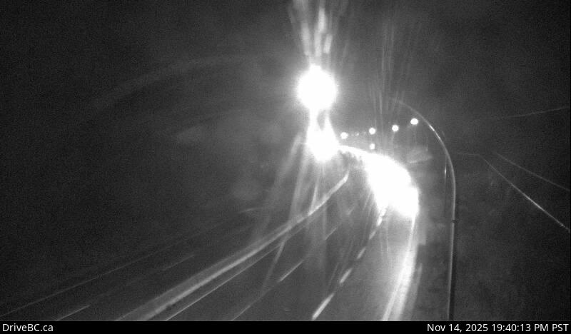
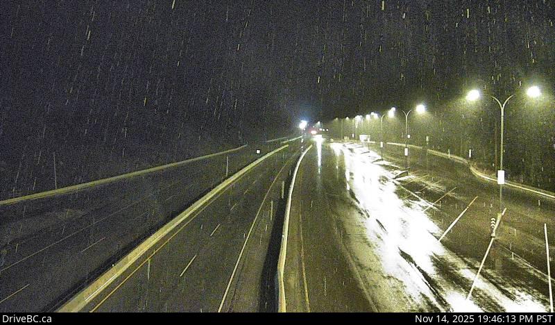
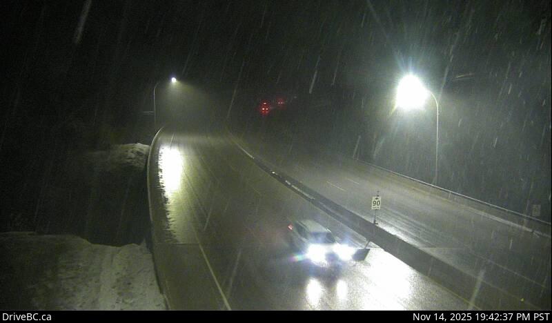
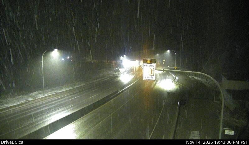
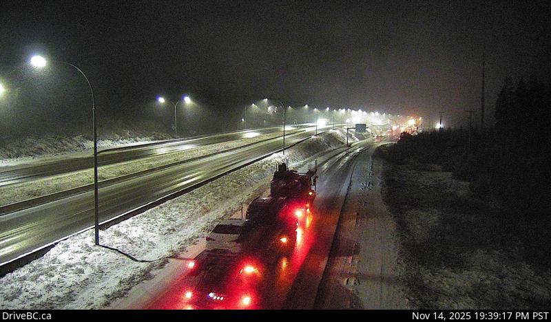
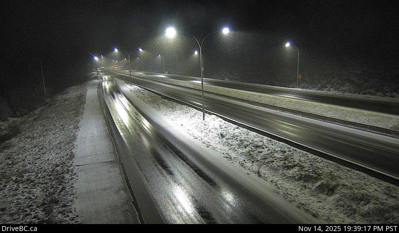
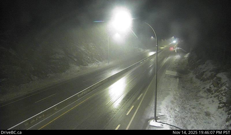
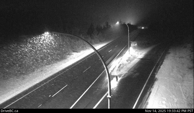
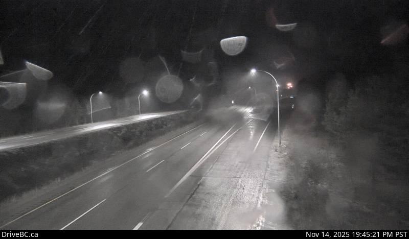
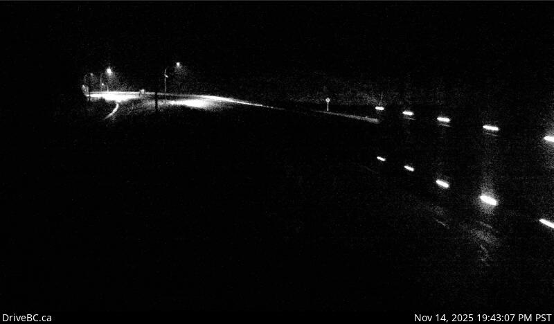
Coquihalla Highway - Hope to Merritt
Monday February 10, 2025 at 02:05 UTC

Sunday nightClear. Fog patches developing after midnight. Wind up to 15 km/h.
MondaySunny. Fog patches lifting in the morning. Wind up to 15 km/h.
Monday nightClear. Wind up to 15 km/h.
Choose highway to view conditions for:


Highway 1 Highway 1 (TransCanada Highway). Bridge maintenance between Mt Sicker Rd and Fuller Lake Rd for 3.7 km (Chemainus). Until Fri Feb 28 at 2:00 AM PST. Lane Closure. Reduced speed zone. NB Bridge closed for repairs. Overwidth protocols Commercial loads 3.2m-3.8m required to pull over and contact for access over SB bridge. Overwidth access only 6-12AM. Loads over 3.8m need 5day notice to accommodate. Next update time Fri Feb 28 at 7:00 AM PST. Last updated Thu Jan 16 at 2:13 PM PST. (DBC-70685)
Highway 1 Both DirectionsHighway 1 (TransCanada Highway), in both directions. Construction work between Coburn St and Shuswap Ave for 0.7 km (Chase). From 7:00 AM to 5:00 PM PST on weekdays and Saturday. 60km/h limit through work zone. Intermittent delays of up to 5 minutes. Four stoppages of up to 20 minutes between 9 AM and 3 PM. Watch for traffic control. Next update time Tue Apr 1 at 5:00 PM PST. Last updated Thu Jan 23 at 10:11 AM PST. (DBC-64961)
Highway 1 Both DirectionsHighway 1 (TransCanada Highway), in both directions. Construction work between Ford Rd and Schneider Pl for 4.5 km (Tappen). Until Sat Oct 31, 2026. From 7:00 AM to 4:00 AM PST on weekdays and Saturday. Expect up to 30 min delays. Reduced speed through work zone to 60 km/hr. Intermittent minor stoppages and single lane alternating traffic. Watch for traffic control. Next update time Thu Feb 27 at 5:00 AM PST. Last updated Mon Jan 27 at 12:01 PM PST. (DBC-72306)
Highway 1 Both DirectionsHighway 1 (TransCanada Highway), in both directions. Blasting between Tappen Beach Rd and 65 Ave NW for 2.6 km (Salmon Arm to 2 km east of Tappen). Until Wed Dec 31. From 7:00 AM to 4:00 AM PST on weekdays and Saturday. 20 minute closure at 1 PM and 30 minute closure at 7 PM daily. Intermittent 5 minute closures and single lane alternating traffic may be required between 7 AM and 4 AM. Next update time Thu Feb 27 at 5:00 PM PST. Last updated Mon Jan 27 at 12:01 PM PST. (DBC-72305)
Highway 1 Both DirectionsHighway 1 (TransCanada Highway), in both directions. Construction work between Old Sicamous Rd and Solsqua-Sicamous Rd for 2.0 km (Sicamous). From 9:00 AM to 3:00 PM PST on weekdays and Saturday. Bridge is closed. Use alternate route. Single lane alternating traffic nightly 8pm to 6am. Next update time Sat Feb 15 at 12:00 PM PST. Last updated Sat Feb 8 at 12:15 PM PST. (DBC-70490)
Highway 1 Both DirectionsHighway 1 (TransCanada Highway), in both directions. Construction work between Tillicum Rd and Exit 6: McKenzie Ave for 1.1 km (Saanich). Until Wed Dec 24, 2025. From 8:00 PM to 5:30 AM PST on weekdays and Sunday. Lane closures in both directions in effect. Traffic reduced to single lane both directions. Maximum width 4m. No maximum height change. Speed limit 50km/h. Last updated Fri Dec 20 at 9:03 AM PST. (DBC-71006)
Highway 1 Both DirectionsHighway 1 (TransCanada Highway), in both directions. Electrical maintenance planned at Cobble Hill Rd (Mill Bay). Starting Thu Feb 13 at 7:00 PM PST until Fri Feb 14 at 4:00 AM PST. Lane closures in both directions planned. Last updated Fri Feb 7 at 12:48 PM PST. (DBC-72684)
Highway 1 Both DirectionsHighway 1 (TransCanada Highway), in both directions. Utility work planned between Nightingale Rd and Trans-Canada Hwy Frtg for 6.2 km (Cobble Hill). Starting Mon Feb 10 at 9:00 AM PST until Tue Feb 11 at 3:00 PM PST. Right lane will be closed. Expect minor delays. Watch for traffic control personnel. Fiber Optic Cable placement- Hwy 1 between Lakeside Rd and Chapman Rd. Watch for work crews. Last updated Tue Feb 4 at 1:09 PM PST. (DBC-72586)
Highway 1 SouthboundHighway 1 (TransCanada Highway), southbound. Utility work planned between Cowichan Bay Rd and Deloume Rd for 7.3 km (Mill Bay to Cobble Hill). Starting Thu Feb 13 at 9:00 AM PST until Thu Feb 13 at 2:00 PM PST. Right lane will be closed. Expect minor delays. Watch for traffic control personnel. Utility Maintenance - watch for speed reduction and work crews. Last updated Fri Feb 7 at 5:39 PM PST. (DBC-72328)
Highway 1 Both DirectionsHighway 1 (TransCanada Highway), in both directions. Utility work planned between Green Rd and Norcross Rd for 0.7 km (Duncan). Starting Mon Feb 10 at 9:00 AM PST until Mon Feb 10 at 3:00 PM PST. Right lane will be closed. Watch for traffic control personnel. Expect minor delays. Emergency Intersection Cable repair - Intersection lights not functioning during repair and will be manually controlled. Watch for work crews. Last updated Fri Feb 7 at 3:58 PM PST. (DBC-72692)
Highway 1 NorthboundHighway 1 (TransCanada Highway), northbound. Utility work planned between River Rd and Panorama Ridge Rd for 1.9 km (Chemainus). Starting Tue Feb 11 at 9:00 AM PST until Wed Feb 12 at 3:00 PM PST. Right lane will be closed. Expect minor delays. Watch for traffic control personnel. BC HYDRO overhead line maintenance - watch for work crews. Last updated Thu Feb 6 at 8:06 AM PST. (DBC-72568)
Highway 1 NorthboundHighway 1 (TransCanada Highway), northbound. Utility work planned between Brenton-Page Rd and Timberlands Rd for 2.2 km (6 to 4 km north of Ladysmith). Starting Mon Feb 10 at 9:00 PM PST until Fri Feb 28 at 6:00 AM PST. Right lane will be closed. Expect minor delays. Watch for traffic control personnel. Watermain install - watch for speed reduction and work crews. Last updated Thu Feb 6 at 2:21 PM PST. (DBC-71940)
Highway 1 NorthboundHighway 1 (TransCanada Highway), northbound. Construction work between Finlayson St and Nicol St for 0.3 km (Nanaimo). Until Fri Feb 28 at 3:00 PM PST. Right lane closed. Expect minor delays. Watch for traffic control. Construction work - Highway 1 Northbound between Crace St. And Esplanade. Right lane closed. Watch for work crews. Last updated Fri Jan 24 at 9:59 AM PST. (DBC-70846)
Highway 1 EastboundHighway 1 (TransCanada Highway), eastbound. Construction work between Exit 37: Gaglardi Way and King Edward St for 3.2 km (Burnaby to Coquitlam). Until Fri Feb 28, 2025 at 7:00 AM PDT. From 9:30 PM to 7:00 AM PDT daily. Lane Closure. Expect delays. Lane closures are needed to move materials & equipment for the construction of TransLink's North Rd maintenance facility. Last updated Fri Sep 13 at 10:04 PM PDT. (DBC-60503)
Highway 1 WestboundHighway 1 (TransCanada Highway), westbound. Rest area closed at Bradner Rd (Abbotsford). Construction work. For more information on the closure, please refer to Highway 1 Project page: gov.Bc.Ca/264toHighway11#bradner. Next update time Sat Jul 26, 2025 at 9:00 AM PDT. Last updated Thu Sep 26 at 7:34 PM PDT. (DBC-66582)
Highway 1 Both DirectionsHighway 1 (TransCanada Highway), in both directions. Road construction work between Exit 83: Mt Lehman Rd and Exit 90: McCallum Rd for 3.9 km (Abbotsford). Until Fri Feb 28. From 8:30 PM to 5:30 AM PST on weekdays and Sunday. Left lane is closed in both directions. Watch for traffic control. Right lane closed intermittently. Last updated Wed Jan 29 at 5:33 PM PST. (DBC-72384)
Highway 1 Highway 1 (TransCanada Highway). Utility work between Gladwin Rd and Nicomen River Rd for 4.0 km (10 to 14 km east of Lytton). Until Sun Feb 23 at 7:00 PM PST. Single lane alternating traffic. Watch for traffic control. Last updated Sun Feb 9 at 1:15 PM PST. (DBC-72714)
Highway 1 Highway 1 (TransCanada Highway). Road construction work between Gladwin Rd and Nicomen River Rd for 0.1 km (10 km east of Lytton). Until Mon Sep 15 at 10:00 AM PST. From 7:00 AM to 5:30 PM PST daily. Intermittent traffic stoppages and single lane alternating traffic. Expect up to 40 minute delays due to railway crossing and construction activities. Next update time Mon Sep 15 at 10:00 AM PST. Last updated Sat Jan 4 at 6:11 PM PST. (DBC-69330)
Highway 1 Highway 1 (TransCanada Highway). Watch for slippery sections between Waverly Park Frtg and Quartz Creek Bridge (Structure) for 243.1 km (15 km east of Chase to 14 km east of East Boundary of Glacier National Park). Compact snow. Last updated Sun Feb 9 at 6:09 PM PST. (DBCRCON-215254)
Highway 1 Both DirectionsHighway 1 (TransCanada Highway), in both directions. Utility work between Canoe Beach Dr NE and Old Sicamous Rd for 19.1 km (Salmon Arm to Sicamous). Until Fri Mar 14 at 4:00 PM PST. Single lane alternating traffic. Last updated Wed Jan 22 at 12:17 PM PST. (DBC-72184)
Highway 1 Both DirectionsHighway 1 (TransCanada Highway), in both directions. Utility work planned between Enquist Frtg and Cambie-Solsqua Rd for 3.9 km (3 to 7 km east of Sicamous). Starting Mon Feb 10 at 8:00 AM PST until Fri Feb 14 at 4:00 PM PST. Single lane alternating traffic will be in effect. Last updated Mon Feb 3 at 9:15 AM PST. (DBC-72534)
Highway 1 Both DirectionsHighway 1 (TransCanada Highway), in both directions. Bridge maintenance planned between Eagle River at Kay Falls Bridge and 19 Mile OH Bridge for 4.6 km (27 to 32 km west of Revelstoke). Starting Mon Feb 10 at 7:00 AM PST until Mon Feb 10 at 3:00 PM PST. Single lane alternating traffic will be in effect. Expect minor delays. Watch for traffic control personnel. Last updated Sun Feb 9 at 10:11 AM PST. (DBC-72712)
Highway 1 WestboundHighway 1 (TransCanada Highway), westbound. Geotechnical investigation planned between Skunk Cabbage Boardwalk and West Boundary of Mount Revelstoke National Park (1 km east of West Boundary of Mount Revelstoke National Park). Starting Mon Feb 10 at 9:00 AM PST until Mon Feb 10 at 5:00 PM PST. Watch for traffic control personnel. Lane Closure. Last updated Thu Jan 30 at 4:39 PM PST. (DBC-72427)
Highway 1 Highway 1 (TransCanada Highway). Watch for slippery sections between Columbia West FSR and Field and Visitor Centre Access Rd for 96.8 km (14 km east of East Boundary of Glacier National Park to Field). Last updated Sun Feb 9 at 6:15 PM MST. (DBCRCON-215190)
Highway 1 Both DirectionsHighway 1 (Kicking Horse Pass), in both directions. Watch for falling rocks between Golden Donald Upper Rd and Yoho Bridge (5 km east of Golden). Last updated Wed Jan 15 at 1:22 AM MST. (DBC-44269)
Highway 1 Highway 1 (Kicking Horse Pass). Compact ice between Emerald Lake Rd and BC/Alberta Border for 16.9 km (Field). Watch for slippery sections. Last updated Sun Feb 9 at 6:15 PM MST. (DBCRCON-215080)
Highway 3 Highway 3 . Maintenance planned at Newton Road 5 km east of Keremeos. Starting Mon Jun 2 at 7:00 AM PST until Fri Jun 6 at 4:00 PM PST. Shoulder will be closed. Work taking place on Newton Road. Last updated Mon Jan 27 at 4:23 PM PST. (DBC-72315)
Highway 3 Highway 3 (Crowsnest Highway). Slushy with slippery sections between the start of Highway 3 (Crowsnest Highway) and Sunshine Valley for 20.8 km (Hope). Last updated Sun Feb 9 at 5:01 PM PST. (DBCRCON-215259)
Highway 3 Highway 3 (Crowsnest Highway). Compact snow between First Avalanche Gate and Sunday Summit for 78.6 km (17 km east of Hope to 32 km west of Princeton). Last updated Sun Feb 9 at 3:49 PM PST. (DBCRCON-214970)
Highway 3 Highway 3 (Crowsnest Highway). Watch for slippery sections between Garret Rd and Daly Ave for 71.8 km (32 km west of Princeton to Hedley). Last updated Sun Feb 9 at 6:09 PM PST. (DBCRCON-215247)
Highway 3 Both DirectionsHighway 3 (Crowsnest Highway), in both directions. Construction work between Vermilion Ave and Taylor Mill Rd for 3.2 km (Princeton). Until Fri Mar 14. From 7:30 AM to 5:00 PM PST on weekdays. Single lane alternating traffic. Speed reduction to 50km/h. Last updated Tue Feb 4 at 3:57 PM PST. (DBC-72593)
Highway 3 Highway 3 (Crowsnest Highway). Watch for slippery sections between Nine Mile Place Rd and Beadman Rd for 27.7 km (20 km east of Osoyoos to Rock Creek). Last updated Sun Feb 9 at 3:43 PM PST. (DBCRCON-215091)
Highway 3 Highway 3 (Crowsnest Highway). Watch for slippery sections between Gowrie St and Granby Rd for 38.8 km (1 km east of Greenwood to Grand Forks). Last updated Sun Feb 9 at 3:43 PM PST. (DBCRCON-215221)
Highway 3 Highway 3 (Crowsnest Highway). Watch for slippery sections between 68th Ave and Mannix Rd for 39.8 km (Christina Lake to 24 km west of Castlegar). Last updated Sun Feb 9 at 3:42 PM PST. (DBCRCON-215222)
Highway 3 Highway 3 (Crowsnest Highway). Watch for slippery sections between Highway 3B and Meadows Rd for 53.7 km (24 km west of Castlegar to 10 km west of Salmo). Compact snow. Last updated Sun Feb 9 at 3:42 PM PST. (DBCRCON-215217)
Highway 3 Highway 3 (Crowsnest Highway). Watch for slippery sections between Junction Hwy 3B and Junction Hwy 6NS for 24.5 km (Salmo). Last updated Sun Feb 9 at 3:43 PM PST. (DBCRCON-214702)
Highway 3 Highway 3 (Crowsnest Highway). Watch for slippery sections between Tailings Rd and Cook St for 68.9 km (14 km east of Salmo to Creston). Compact snow. Last updated Sun Feb 9 at 2:50 PM PST. (DBCRCON-214703)
Highway 3 Highway 3 (Crowsnest Highway). Watch for falling rocks between Junction Hwy 6NS and Lower Wynndel Rd for 64.6 km (1 km west of Creston to 14 km east of Salmo). Watch for falling ice. Last updated Sun Feb 9 at 6:41 AM PST. (DBC-72143)
Highway 3 Highway 3 (Crowsnest Highway). Winter driving conditions between Wright Rd and Tavistock St for 41.2 km (5 km west of Curzon Junction to Moyie). Compact snow. Last updated Sun Feb 9 at 3:06 PM PST. (DBCRCON-215212)
Highway 3 Highway 3 (Crowsnest Highway). Winter driving conditions between Sunrise Rd and White Cloud Pit Rd for 69.0 km (Moyie to 9 km west of Jaffray). Last updated Sun Feb 9 at 3:59 PM MST. (DBCRCON-215213)
Highway 3 EastboundHighway 3 (Crowsnest Highway), eastbound. Maintenance planned between Wardner-Fort Steele Rd and Jaffray-Baynes Lake Rd for 10.5 km (Jaffray). Starting Wed Feb 12 at 8:00 AM MST until Wed Feb 12 at 5:00 PM MST. Right lane will be closed. Expect intermittent stops under 5 minutes. Last updated Wed Feb 5 at 4:09 PM MST. (DBC-72624)
Highway 3 Highway 3 (Crowsnest Highway). Winter driving conditions between Junction Rd and 4th St for 31.0 km (1 km west of Elko to Fernie). Compact snow. Snowing. Last updated Sun Feb 9 at 4:32 AM MST. (DBCRCON-215099)
Highway 3 Highway 3 (Crowsnest Highway). Winter driving conditions between Riverside Dr and Michel Creek Rd for 32.4 km (Fernie to Sparwood). Last updated Sun Feb 9 at 10:02 AM MST. (DBCRCON-215199)
Highway 3 Highway 3 (Crowsnest Highway). Winter driving conditions between Michel Mouth Bridge and BC/AB Border for 17.8 km (Sparwood to British Columbia and Alberta Border). Watch for slippery sections. Compact snow. Last updated Sun Feb 9 at 3:50 PM MST. (DBCRCON-215200)
Highway 5 Highway 5 (Coquihalla South). Slushy with slippery sections between the start of Highway 5 (Coquihalla South) and Exit 202: Portia for 24.8 km (Hope to 11 km south of Great Bear Snowshed). Last updated Sun Feb 9 at 5:01 PM PST. (DBCRCON-215260)
Highway 5 Both DirectionsHighway 5 (Coquihalla South), in both directions. Pothole repair between Exit 202: Portia and Exit 256: Coldwater Rd for 54.9 km (11 km south of Great Bear Snowshed to 29 km south of Merritt). Watch for potholes along the roadway. Drive with caution. Last updated Sat Dec 28 at 4:38 PM PST. (DBC-71507)
Highway 5 Highway 5 (Coquihalla South). Watch for slippery sections between Exit 202: Portia and Exit 256: Coldwater Rd for 54.9 km (11 km south of Great Bear Snowshed to 29 km south of Merritt). Compact snow. Last updated Sun Feb 9 at 3:44 PM PST. (DBCRCON-215229)
Highway 5 Highway 5 (Coquihalla South). Watch for slippery sections between Exit 286: Merritt - 97C and Exit 336: Walloper Interchange for 49.9 km (Merritt to 14 km north of Surrey Lake Summit). Last updated Sun Feb 9 at 3:44 PM PST. (DBCRCON-215230)
Highway 5 Highway 5 (Coquihalla North). Watch for slippery sections between Exit 336: Walloper Interchange and Exit 362: Afton Interchange for 27.2 km (14 km north of Surrey Lake Summit to Kamloops). Compact snow. Last updated Sun Feb 9 at 6:09 PM PST. (DBCRCON-215231)
Highway 5 Highway 5. Watch for slippery sections between McMurphy Pullout; SA Boundary and 5th Ave; Pine Rd for 147.2 km (18 km south of Avola to Valemount). Compact snow. Last updated Sun Feb 9 at 3:59 PM PST. (DBCRCON-215194)
Highway 5 Both DirectionsHighway 5, in both directions. Roadside brushing between Deejay Rd and Wire Cache Rest Area for 106.5 km (18 km south of Avola to 1 km north of Barriere). Until Fri Feb 28. From 6:00 AM to 6:00 PM PST daily. Watch for slow moving vehicles. Sections of single lane alternating traffic. Slow down for crews and expect delays. Last updated Tue Jan 28 at 11:12 AM PST. (DBC-72335)
Highway 5 Highway 5. Compact snow between 5th Ave; Pine Rd and the end of Highway 5 for 19.4 km (Valemount to Tete Jaune). Last updated Sun Feb 9 at 3:57 PM PST. (DBCRCON-215195)

Chilliwack Forecast

Current Conditions

0.7 C

Sun night

Low -6.
Clear

Mon

High 1.
Sunny

Mon night

Low -8.
Clear

Tues

High -1.
Sunny

Tues night

Low -7.
Clear

Wed

High 2.
Sunny

Wed night

Low -5.
Clear

Thurs

High 2.
Sunny

Hope Forecast

Current Conditions


-2.3 C

Sun night

Low -9.
Clear

Mon

High -2.
Sunny

Mon night

Low -11.
Clear

Tues

High -1.
Sunny

Tues night

Low -7.
Clear

Wed

High 2.
Sunny

Wed night

Low -5.
Clear

Thurs

High 2.
Sunny

Merritt Forecast

Current Conditions

-16.6 C

Sun night

Low -24.
A few clouds

Mon

High -7.
Mainly sunny

Mon night

Low -23.
A few clouds

Tues

High -8.
Sunny

Tues night

Low -20.
Clear

Wed

High -10.
Sunny

Wed night

Low -17.
Clear

Thurs

High -4.
Sunny

MISC INFO

AST-1 COURSE DETAILS 

- Classroom time is now done ON-LINE.  There are several short Avalanche video's you'll need to watch, then one Zoom meeting for the classroom time.  There is one field day in the snow.   You don't need to be an experienced rider to take the course.

- you do need your own sled and you must have a Beacon, Shovel and Probe (like every sledder should have).

- you will gain knowledge and skills to help you stay out of harm's way using the planning technology available via Avalanche Canada and other resources.

- you will learn to look critically at winter landscape, judging the terrain and snowpack, detect danger zones and safe routes to follow

- you will become fast and accurate rescuers, honing your skills with avalanche transceiver, probe and shovel, getting you prepared for any situation.

- $350 per person, $300 for CoqSnow members, Youth/Volunteers $250, $100 discount if you've taken course before.

- Text or Call Gerald @ 604-316-1600 to sign-up