


0-K Parking Lot (1110m)

Peanut Bowl (1690m)

Spearing Bowl (1800m)

10-K Cabin (1820m)
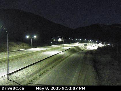
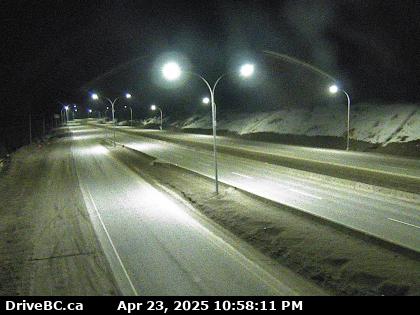
BC Highway Webcams


| The forecasts for the B.C. Travellers Routes have ended for the season and will resume on October 1. |
| Highway 1 Both Directions | Highway 1 (TransCanada Highway), in both directions. Construction work at Exit 165: Flood Rd (Hope). Lane Closure. Exit ramp is closed. Expect delays. Eastbound exit 165 closed, use exit 168. Next update time Fri May 30 at 9:00 AM PDT. Last updated Fri May 9 at 9:28 AM PDT. (DBC-73987) |
| Highway 1 Both Directions | Highway 1 (TransCanada Highway), in both directions. Road construction work between Gladwin Rd and Nicomen River Rd for 1.1 km (10 to 11 km east of Lytton). From 7:00 AM to 5:30 PM PDT daily. Future Planned Closure: May 20th, 2025 12:01AM - 4:00AM. Until further notice, full time single lane alternating traffic. Expect up to 40-minute delays due to railway crossing and construction activities. Next update time Mon Sep 15 at 10:00 AM PDT. Last updated Wed May 14 at 5:46 PM PDT. (DBC-75637) |
| Highway 1 Both Directions | Highway 1 (TransCanada Highway), in both directions. Construction work between Coburn St and Shuswap Ave for 0.7 km (Chase). From 7:00 AM to 5:00 PM PDT on weekdays and Saturday. May 13-Aug 16 7am-5pm Monday to Saturday 60km/h. 80km/h outside construction hours. Watch for traffic control. Next update time Sat Aug 16 at 10:00 AM PDT. Last updated Mon May 12 at 5:31 PM PDT. (DBC-64961) |
| Highway 1 Both Directions | Highway 1 (TransCanada Highway), in both directions. Construction work between Ford Rd and Bolton Rd for 4.5 km (Tappen). Until Wed Dec 31. From 7:00 AM to 5:00 PM PST on weekdays and Saturday. Expect up to 20 min delays. Reduced speed through work zone to 60 km/hr. Intermittent minor stoppages and single lane alternating traffic. Watch for traffic control. Next update time Mon Dec 1 at 9:00 AM PST. Last updated Thu Feb 27 at 1:35 PM PST. (DBC-72306) |
| Highway 1 Both Directions | Highway 1 (TransCanada Highway), in both directions. Blasting between Tappen Beach Rd and 65 Ave NW for 2.6 km (Salmon Arm to 2 km east of Tappen). Until Sat May 31. From 7:00 AM to 5:00 PM PST on weekdays and Saturday. 20 minute closure at 1 PM. Intermittent 5 minute closures and single lane alternating traffic may be required. Next update time Mon May 26 at 9:00 AM PST. Last updated Thu Feb 27 at 1:27 PM PST. (DBC-72305) |
| Highway 1 | Highway 1 (TransCanada Highway). Construction work between Old Sicamous Rd and Solsqua-Sicamous Rd for 2.0 km (Sicamous). From 9:00 AM to 3:00 PM PDT on weekdays and Saturday. Road closed. Single lane alternating traffic 8 PM to 6 AM Mon-Thurs. No closures from Friday, May 16th, to Tuesday, May 20th. Closures to resume May 20th at 12:00 PM to 3:00 PM. Next update time Tue May 20 at 3:00 PM PDT. Last updated Mon May 12 at 4:39 PM PDT. (DBC-70490) |
| Highway 1 Both Directions | Highway 1 (TransCanada Highway), in both directions. Construction work between Illecillewaet Brake Check and MacDonald Snowshed for 3.0 km (5 to 2 km west of West Boundary of Glacier National Park). Until Fri May 16. Travelers should expect traffic delays up to 30 min between 7PM and 8AM. Next update time Fri May 16 at 12:00 PM PDT. Last updated Wed May 14 at 9:05 PM PDT. (DBC-73974) |
| Highway 1 Both Directions | Highway 1 (TransCanada Highway), in both directions. Construction work planned between Illecillewaet Brake Check and MacDonald Snowshed for 3.0 km (5 to 2 km west of West Boundary of Glacier National Park). Starting Thu May 15 at 10:00 AM PDT until Thu May 15 at 11:00 AM PDT. Road closure planned. Next update time Thu May 15 at 11:00 AM PDT. Last updated Tue May 13 at 11:22 AM PDT. (DBC-76579) |
| Highway 1 Both Directions | Highway 1 (TransCanada Highway), in both directions. Utility work planned between Roderick St and Culduthel Rd for 0.6 km (Saanich). Starting Mon Jul 7 at 10:00 PM PST until Tue Sep 30 at 5:00 AM PST. Right lane will be closed. Left lane will be closed. Expect minor delays. Watch for traffic control personnel. Last updated Wed Feb 19 at 11:59 AM PST. (DBC-72994) |
| Highway 1 Both Directions | Highway 1 (TransCanada Highway), in both directions. Construction work between Tillicum Rd and Exit 6: McKenzie Ave for 1.1 km (Saanich). Until Wed Dec 24, 2025. From 8:00 PM to 5:30 AM PST on weekdays and Sunday. Lane closures in both directions in effect. Traffic reduced to single lane both directions. Maximum width 4m. No maximum height change. Speed limit 50km/h. Last updated Fri Dec 20 at 9:03 AM PST. (DBC-71006) |
| Highway 1 | Highway 1 (TransCanada Highway). Road construction work between Exit 6: McKenzie Ave and Exit 10: Burnside Rd W for 3.8 km (View Royal to Saanich). Construction work at Colwood Interchange, Helmcken Interchange, and McKenzie Interchange until Fall 2027. Expect speed changes, traffic pattern changes, and overnight work. Next update time Fri Jun 13 at 10:00 AM PDT. Last updated Tue Mar 25 at 4:46 PM PDT. (DBC-73856) |
| Highway 1 | Highway 1 (TransCanada Highway). Utility work planned between Trunk Rd and York Rd for 0.6 km (Duncan). Starting Tue May 20 until Sat Jun 14 at 4:00 PM PDT. Coronation Avenue bike lanes project. Work is on Coronation Avenue. Last updated Mon May 5 at 7:25 AM PDT. (DBC-74880) |
| Highway 1 Northbound | Highway 1 (TransCanada Highway), northbound. Construction work between Finlayson St and Nicol St for 0.3 km (Nanaimo). Until Thu May 29 at 3:00 PM PDT. Right lane closed. Expect minor delays. Watch for traffic control. Construction work - Highway 1 Northbound between Crace St. And Esplanade. Right lane closed. Watch for work crews. Last updated Mon Apr 21 at 11:59 AM PDT. (DBC-70846) |
| Highway 1 Both Directions | Highway 1 (TransCanada Highway), in both directions. Road construction work between 216th St and Exit 73 for 9.3 km (Langley - District). Until Mon Jun 30. From 8:30 PM to 8:00 AM PDT on weekends and from 8:30 PM to 5:30 AM PDT on weekdays. Night time construction work. Left lane is closed in both directions. Last updated Fri Mar 21 at 1:14 PM PDT. (DBC-74277) |
| Highway 1 | Highway 1 (TransCanada Highway). Construction work between 216th St and Exit 73 for 11.4 km (Langley - District). Until Mon Jun 30. From 8:30 PM to 5:00 AM PDT daily. Lane closures in both directions in effect. Last updated Tue Apr 1 at 8:54 AM PDT. (DBC-74725) |
| Highway 1 Eastbound | Highway 1 (TransCanada Highway), eastbound. Road construction work at Exit 73 (Langley - District). Until Sat May 31 at 5:30 AM PDT. From 9:00 PM to 5:30 AM PDT on weekdays and Saturday. Shoulder maintenance. Exit ramp work on shoulder. Last updated Tue Apr 1 at 4:32 PM PDT. (DBC-74748) |
| Highway 1 Westbound | Highway 1 (TransCanada Highway), westbound. Maintenance at Exit 73 (Langley - District). Until Sat May 31 at 7:00 AM PDT. From 9:00 PM to 7:00 AM PDT on Saturday and from 9:00 PM to 5:30 AM PDT on weekdays. Shoulder closed. Last updated Tue Apr 1 at 4:43 PM PDT. (DBC-74751) |
| Highway 1 Westbound | Highway 1 (TransCanada Highway), westbound. Rest area closed at Bradner Rd (Abbotsford). Construction work. For more information on the closure, please refer to Highway 1 Project page: gov.Bc.Ca/264toHighway11#bradner. Next update time Sat Jul 26, 2025 at 9:00 AM PDT. Last updated Thu Sep 26 at 7:34 PM PDT. (DBC-66582) |
| Highway 1 Westbound | Highway 1 (TransCanada Highway), westbound. Geotechnical investigation between Riverside Rd and Exit 90: McCallum Rd for 0.6 km (Abbotsford). Until Fri May 23. From 8:00 PM to 5:00 AM PDT daily. Shoulder closed. Last updated Mon Apr 28 at 1:41 PM PDT. (DBC-75906) |
| Highway 1 Eastbound | Highway 1 (TransCanada Highway), eastbound. Utility work planned between Nicomen River Rd and Junction Hwy 8 for 1.7 km (14 to 12 km west of Spences Bridge). Starting Wed May 21 at 8:00 AM PDT until Thu May 22 at 6:00 PM PDT. Single lane alternating traffic will be in effect. Watch for traffic control personnel. Last updated Tue May 13 at 8:00 AM PDT. (DBC-76568) |
| Highway 1 Both Directions | Highway 1 (TransCanada Highway), in both directions. Utility work between Nicomen River Rd and Junction Hwy 8 (13 km west of Spences Bridge). Until Fri May 16 at 4:00 PM PDT. From 8:00 AM to 4:00 PM PDT on weekdays. Single lane alternating traffic. Last updated Tue May 13 at 8:00 AM PDT. (DBC-76567) |
| Highway 1 Westbound | Highway 1 (TransCanada Highway), westbound. Utility work between Juniper Beach Prov Park Access Rd and Back Valley Rd for 3.8 km (10 to 14 km east of Cache Creek). Until Fri May 23. From 8:00 AM to 4:00 PM PDT daily. Lane Closure. Single lane alternating traffic. Watch for traffic control. Last updated Thu May 1 at 4:16 PM PDT. (DBC-75457) |
| Highway 1 Eastbound | Highway 1 (TransCanada Highway), eastbound. Utility work between Bale Rd and Pinecrest Dr for 1.9 km (24 to 22 km east of Cache Creek). Until Fri May 16 at 4:00 PM PDT. From 8:00 AM to 4:00 PM PDT daily. Lane Closure. Single lane alternating traffic. Watch for traffic control. Last updated Mon Apr 21 at 12:03 PM PDT. (DBC-75458) |
| Highway 1 Both Directions | Highway 1 (TransCanada Highway), in both directions. Paving operations planned between Pat Rd and Miners Bluff Rd for 17.7 km (Kamloops). Starting Tue May 20 until Fri Jun 27 at 7:00 PM PDT. From 7:00 AM to 7:00 PM PDT on weekdays and Saturday. Lane Closure. Watch for traffic control personnel. Last updated Wed May 14 at 7:22 AM PDT. (DBC-76609) |
| Highway 1 Both Directions | Highway 1 (TransCanada Highway), in both directions. Construction work planned between Stoney Flats Rd and Chief Neskonlith Dr for 8.0 km (5 to 13 km west of Chase). Starting Tue May 27 at 8:00 AM PDT until Fri May 30 at 4:00 PM PDT. Single lane alternating traffic will be in effect. Expect minor delays. Last updated Wed May 14 at 1:05 PM PDT. (DBC-76630) |
| Highway 1 Eastbound | Highway 1 (TransCanada Highway), eastbound. Utility work planned between Little River Rd and Des Fosses Rd for 0.9 km (13 to 14 km east of Chase). Starting Fri May 16 at 10:00 AM PDT until Fri May 16 at 2:00 PM PDT. Lane Closure. Last updated Thu May 1 at 10:54 AM PDT. (DBC-76056) |
| Highway 1 Both Directions | Highway 1 (TransCanada Highway), in both directions. Tree pruning between Loftus Rd and Rutherford-Three Valley Rest Area for 30.4 km (16 km east of Sicamous to 19 km west of Revelstoke). Until Fri May 23 at 5:00 PM PDT. From 7:00 AM to 5:00 PM PDT on weekdays. Single lane alternating traffic. Last updated Wed Apr 30 at 3:05 PM PDT. (DBC-75910) |
| Highway 1 Eastbound | Highway 1 (TransCanada Highway), eastbound. Utility work planned between 19 mile Rd and Back Rd for 23.4 km (26 to 3 km west of Revelstoke). Starting Mon May 26 until Thu May 29 at 4:00 PM PDT. From 8:00 AM to 4:00 PM PDT daily. Right lane will be closed. Watch for traffic control personnel. Last updated Wed May 14 at 12:06 PM PDT. (DBC-76629) |
| Highway 1 Both Directions | Highway 1 (TransCanada Highway), in both directions. Rock slope stabilization between Three Valley Avalanche Gate and Three Valley Frtg Rd for 2.1 km (18 to 16 km west of Revelstoke). Until Sun May 18 at 5:00 PM PDT. From 5:00 AM to 5:00 PM PDT on weekdays and Saturday. Single lane alternating traffic. Expect delays of 20 minutes. Last updated Wed May 7 at 7:00 PM PDT. (DBC-74730) |
| Highway 1 Both Directions | Highway 1 (TransCanada Highway), in both directions. Construction work between Woods OH Bridge and Boulder Mtn Avalanche Gate for 4.2 km (8 to 12 km west of Revelstoke). Until Sun Aug 31. From 7:00 PM to 7:00 AM PDT daily. Speed reduction to 30km/h during construction. Last updated Fri Apr 25 at 5:56 PM PDT. (DBC-75826) |
| Highway 1 Both Directions | Highway 1 (TransCanada Highway), in both directions. Bridge construction planned at Meadows in the Sky Pkwy (Revelstoke). Starting Tue May 20 until Fri Oct 31. Watch for traffic control personnel. Lane Closure. Expect speed reductions to 50km/hr. No work on long weekends. Last updated Tue May 13 at 2:27 PM PDT. (DBC-76584) |
| Highway 1 | Highway 1 (TransCanada Highway). Crack sealing is underway between Woolsey Creek Bridge and Albert Canyon West Bridge for 3.2 km (East Boundary of Mount Revelstoke National Park). Until Thu May 15 at 3:00 PM PDT. Single lane alternating traffic. Last updated Wed May 14 at 5:00 PM PDT. (DBC-76649) |
| Highway 1 | Highway 1 (TransCanada Highway). Rest area closed at Redgrave Rest Area (14 km east of East Boundary of Glacier National Park). Redgrave rest area is permanently closed. New rest area will be built just west of the current location. Stay tuned for more updates as construction progresses. Next update time Mon May 19 at 9:00 AM MDT. Last updated Mon May 5 at 9:57 AM MDT. (DBC-73964) |
| Highway 1 Both Directions | Highway 1 (TransCanada Highway), in both directions. Maintenance between Redgrave Rest Area and Anderson Rd for 39.9 km (14 km east of East Boundary of Glacier National Park to 1 km west of Golden). From 8:00 AM to 3:30 PM MDT on Monday and Tuesday. Last updated Mon May 5 at 8:18 AM MDT. (DBC-76164) |
| Highway 1 Both Directions | Highway 1 (TransCanada Highway), in both directions. Road construction work between Redgrave Rest Area and Wiseman Rd for 6.0 km (15 to 21 km east of East Boundary of Glacier National Park). Until Mon Oct 27. From 7:00 AM to 7:00 PM MDT daily. Construction zone reduced speed limit in effect. Lane widths are 5 metres each direction. Watch for crews and expect delays. Next update time Tue Jul 15 at 12:00 PM MDT. Last updated Tue Apr 15 at 9:05 PM MDT. (DBC-75437) |
| Highway 1 | Highway 1 (TransCanada Highway). Bridge maintenance between Forde Station Rd and Kicking Horse Rest Area for 31.6 km (Golden). Until Thu May 15 at 3:00 PM MDT. From 8:00 AM to 3:00 PM MDT on Monday, Tuesday, Wednesday and Thursday. Right lane closed. Reduce Speed, Watch for crews and equipment. Last updated Mon May 12 at 4:14 PM MDT. (DBC-76488) |
| Highway 1 | Highway 1 (TransCanada Highway). Electrical maintenance between Donald Bridge and Anderson Rd for 24.0 km (Golden to 24 km west of Golden). Until Thu May 15 at 7:00 PM MDT. Single lane alternating traffic. Last updated Tue May 13 at 10:23 AM MDT. (DBC-76575) |
| Highway 1 Both Directions | Highway 1 (Kicking Horse Pass), in both directions. Watch for falling rocks between Golden Donald Upper Rd and Yoho Bridge (5 km east of Golden). Debris on roadway. Last updated Thu May 15 at 7:36 AM MDT. (DBC-44269) |
| Highway 1 | Highway 1 (Kicking Horse Pass). Maintenance between Golden Donald Upper Rd and West Boundary of Yoho National Park for 24.0 km (West Boundary of Yoho National Park to Golden). Until Thu May 15 at 3:30 PM MDT. Watch for slow moving vehicle. Last updated Mon May 5 at 8:24 AM MDT. (DBC-76167) |
| Highway 3 Both Directions | Highway 3 (Crowsnest Highway), in both directions. Special event planned between 3rd St and 7th Ave for 0.5 km (Keremeos). Starting Mon May 19 at 9:00 AM PDT until Mon May 19 at 12:30 PM PDT. Victoria Day parade. Road closed. Detour via 3rd St and 6th Ave. Watch for traffic control and expect delays. Next update time Mon May 19 at 12:30 PM PDT. Last updated Thu May 8 at 10:53 AM PDT. (DBC-76365) |
| Highway 3 | Highway 3 . Maintenance planned at Newton Road 5 km east of Keremeos. Starting Mon Jun 2 at 7:00 AM PST until Fri Jun 6 at 4:00 PM PST. Shoulder will be closed. Work taking place on Newton Road. Last updated Mon Jan 27 at 4:23 PM PST. (DBC-72315) |
| Highway 3 Both Directions | Highway 3 (Crowsnest Highway), in both directions. Utility work between Sunshine Valley and Allison Pass Summit for 9.7 km (21 to 31 km east of Hope). Until Fri May 16. From 9:00 AM to 4:00 PM PDT daily. Single lane alternating traffic. Watch for traffic control. Last updated Fri Apr 25 at 9:13 AM PDT. (DBC-75788) |
| Highway 3 Both Directions | Highway 3 (Crowsnest Highway), in both directions. Construction work between Second Avalanche Gate and Allison Pass Summit for 7.9 km (33 to 40 km east of Hope). Until Mon Dec 1 at 7:00 PM PDT. From 6:00 AM to 7:00 PM PDT on weekdays. Expect delays. Lane Closure. Temporary detour at Snass Creek Bridge. Last updated Mon Apr 21 at 12:32 PM PDT. (DBC-74724) |
| Highway 3 Both Directions | Highway 3 (Crowsnest Highway), in both directions. Road sweeping between Allison Pass Summit and Monument 78-Monument 83 Trail for 12.7 km (54 km east of Hope to 61 km west of Princeton). Until Thu May 15 at 3:00 PM PDT. Watch for traffic control. Last updated Thu May 15 at 4:17 AM PDT. (DBC-76654) |
| Highway 3 | Highway 3 (Crowsnest Highway). Utility work between Allison Pass Summit and Manning Park Resort (58 km east of Hope). Until Thu May 15 at 4:30 PM PDT. Lane Closure. Hydro Pole replacement from Gibson Pass Rd. To Manning Park. Last updated Tue Apr 15 at 2:51 PM PDT. (DBC-75425) |
| Highway 3 Westbound | Highway 3 (Crowsnest Highway), westbound. Utility work between Garret Rd and Tower Rd for 1.2 km (46 to 47 km west of Princeton). Until Fri May 23 at 3:00 PM PDT. From 9:00 AM to 3:00 PM PDT daily. Right lane is blocked. Speed reduced to 80km/hr. No work on May 16 - May 20. Last updated Thu May 8 at 12:40 PM PDT. (DBC-76369) |
| Highway 3 | Highway 3 (Crowsnest Highway). Watch for falling rocks between Wilgress Lake Rest Area and Granby Rd for 26.1 km (2 km west of Eholt Summit to Grand Forks). Last updated Tue Apr 1 at 4:26 AM PDT. (DBC-73820) |
| Highway 3 | Highway 3 (Crowsnest Highway). Watch for falling rocks between East Lake Dr and Highway 3B for 39.8 km (Christina Lake to 24 km west of Castlegar). Last updated Tue Apr 1 at 4:26 AM PDT. (DBC-73822) |
| Highway 3 | Highway 3 (Crowsnest Highway). Watch for falling rocks between Junction Hwy 6NS and West Creston Rd for 55.4 km (14 km east of Salmo to 10 km west of Creston). Last updated Tue Apr 1 at 4:26 AM PDT. (DBC-73304) |
| Highway 3 Both Directions | Highway 3 (Crowsnest Highway), in both directions. Watch for falling rocks between West Avalanche Gate and East Avalanche Gate for 18.0 km (Kootenay Pass). Next update time Mon Jun 2 at 11:30 AM PDT. Last updated Thu Apr 10 at 11:53 AM PDT. (DBC-75211) |
| Highway 3 Both Directions | Highway 3 (Crowsnest Highway), in both directions. Industrial traffic may slow or block regular traffic. Between Moyie Swansea Bridge and Lumberton Rd for 4.5 km (13 km east of Moyie to 11 km west of Cranbrook). Until Thu May 15 at 2:30 PM MDT. Last updated Tue May 6 at 8:57 AM MDT. (DBC-76240) |
| Highway 5 Northbound | Highway 5 (Coquihalla South), northbound. Bridge maintenance between Exit 183: Othello Rd and Exit 192 for 1.2 km (14 to 15 km north of Hope). Until Thu May 15 at 11:00 AM PDT. Right lane is blocked. Last updated Fri May 9 at 11:32 AM PDT. (DBC-76426) |
| Highway 5 Northbound | Highway 5 (Coquihalla South), northbound. Bridge maintenance between Exit 231: Mine Creek Rd and Exit 250: Larson Hill for 18.6 km (12 to 31 km north of Coquihalla Summit). Until Thu May 15 at 4:00 PM PDT. Lane Closure. Watch for traffic control. Last updated Wed May 14 at 3:51 PM PDT. (DBC-76644) |
| Highway 5 Southbound | Highway 5 (Coquihalla South), southbound. Road sweeping between Exit 276: Comstock Rd and Exit 250: Larson Hill for 26.6 km (31 km north of Coquihalla Summit to 9 km south of Merritt). Until Thu May 15 at 4:30 PM PDT. Left lane is closed. Watch for Crew and Equipment. Speed drop in effect. Last updated Thu May 15 at 5:49 AM PDT. (DBC-76655) |
| Highway 5 Southbound | Highway 5, southbound. Utility work between Holland Rd and Lost Creek Rd for 3.7 km (3 to 7 km north of Clearwater). Until Thu May 15 at 5:00 PM PDT. From 7:00 AM to 5:00 PM PDT daily. Lane Closure. Single lane alternating traffic. Watch for traffic control. Last updated Mon Apr 21 at 12:35 PM PDT. (DBC-73940) |
| Highway 5 | Highway 5. Vehicle recovery planned between Cliff Rd and Holland Rd for 1.4 km (7 km north of Clearwater to 6 km south of Vavenby). Starting Fri May 16 at 8:00 AM PDT until Fri May 16 at 12:00 PM PDT. Eastbound lane will be closed. Watch for traffic control personnel. Last updated Mon May 12 at 10:59 AM PDT. (DBC-76516) |
| Highway 5 Southbound | Highway 5, southbound. Vehicle recovery between Gosnell Bridge and Moonbeam Bridge for 1.7 km (41 to 40 km north of Blue River). Until Thu May 15 at 7:30 PM PDT. Lane Closure. Single lane alternating traffic. Watch for traffic control. Last updated Thu May 15 at 8:44 AM PDT. (DBC-76665) |
Chilliwack Forecast
Current Conditions
Thurs
High 14.
Chance of showers
30%
Thurs night
Low 8.
Showers
Fri
High 17.
Chance of showers
60%
Fri night
Low 10.
Chance of showers
40%
Sat
High 16.
Chance of showers
40%
Sat night
Low 8.
Chance of showers
60%
Sun
High 16.
A mix of sun and cloud
Sun night
Low 8.
Rain
Hope Forecast
Current Conditions

10.2 C
Thurs
High 14.
Chance of showers
30%
Thurs night
Low 8.
Showers
Fri
High 17.
Chance of showers
60%
Fri night
Low 10.
Chance of showers
40%
Sat
High 16.
Chance of showers
40%
Sat night
Low 8.
Chance of showers
60%
Sun
High 16.
A mix of sun and cloud
Sun night
Low 8.
Rain
Merritt Forecast
Current Conditions
Thurs
High 17.
Increasing cloudiness
Thurs night
Low 8.
Chance of showers
60%
Fri
High 16.
Chance of showers
60%
Fri night
Low 6.
Cloudy periods
Sat
High 17.
Cloudy
Sat night
Low 8.
Chance of showers
70%
Sun
High 16.
Chance of showers
60%
Sun night
Low 7.
Chance of showers
40%